Earthquakes are among the most damaging natural phenomena in the world. The study of earthquakes is called seismology, and it’s under the major scientific field of geophysics. For a very long time, people have tried to know when exactly an earthquake will happen. But as we all know, it’s not possible even if we have the most sophisticated monitoring equipment and technology. But what we can always do is to be prepared.
And that’s where this field of science comes in. Our expert guest in today’s Fantastic Subjects is a geologist and seismologist, who we have featured recently in our August 2017 Innovative Education issue. Marie-Luce Chevalier from the Chinese Academy of Geological Sciences tells us more about why her work is important for disaster preparedness… and why this field of science is also shockingly exciting!

What’s it like to be a geologist?
I’m a scientist doing research in tectonic-geomorphology, a sub-discipline of geology, which basically studies the relationship between earthquakes and landscapes. I focus in particular on large active faults located on the Tibetan Plateau to determine their average slip-rate, that is, how active a fault is and how fast it moves, to understand its behavior and ability to produce earthquakes.
What does it involve in terms of daily tasks, resources, or people interacted with?
My job can be divided into three different aspects: fieldwork on the Tibetan Plateau, office work and laboratory work doing experiments.
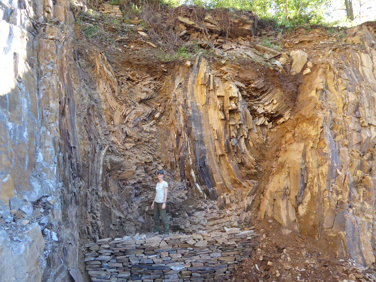
I first look at high-resolution satellite images (such as Google Earth) to find the best sites, i.e. where an active fault is visible in the landscape and has offset fluvial or glacial surfaces due to multiple earthquakes. Indeed, when an earthquake happens, the surface can move from a few centimeters to a few meters, depending on the magnitude of the earthquake.
I then go the field (Tibet, Xinjiang, Sichuan, and Yunnan mainly) to collect rocks from these offset surfaces; then process them in a chemistry laboratory to eventually determine how long they have been exposed at the surface (for example, 20,000 years), especially when the surface was abandoned and the fault could start offsetting the surface due to repetitive earthquakes. Knowing the age of the surfaces and the offset value will give us an average slip-rate (average speed of the fault).
The rest of my time is office-based, reading publications from others, writing grants (to ask for funding to do your research) and scientific papers in which you publish your discoveries (a very time-consuming task), preparing and attending conferences and meetings, and supervising students.
I’m currently funded by the National Natural Science Foundation of China (NSFC). In terms of resources, I need good physical condition and muscles (!) to hike at high elevation, good field gear, a good camera, a hammer and a GPS. We also have very high-tech machines (such as a 3D scanner, also called Terrestrial LiDAR, or a UAV, also called a drone) to survey the topography of our sites and measure the offsets at the precision of a millimeter or so. When doing experiments, we use very dangerous chemicals that require proper handling wearing special clothing and accessories in a special clean laboratory.
I interact with other colleagues and students at my institute on a daily basis, and with other scientists and collaborators from abroad, in my field or a related field during international conferences.
What are some of the interesting projects that you have done so far?
My main research project (started during my Ph.D.) was to determine the average slip-rate of the Karakoram fault system, a major active fault in western Tibet. No large earthquake has ever been recorded despite the clear trace of the fault in the landscape and very large offsets (up to 2km). Therefore, a long overdue earthquake may strike the region in the near future.
My current project is on the Xianshuihe fault system, in western Sichuan and Qinghai. It is one of the most active faults on Earth, with more than 20 earthquakes of greater than magnitude 6.5 since 1700, including the 2010 magnitude 6.9 Yushu earthquake, or three earthquakes of greater than magnitude 7.3 since 1923. For reference, the nearby devastating Wenchuan earthquake in 2008 was magnitude 7.9. It is therefore essential to study the Xianshuihe fault system in detail in order to evaluate regional earthquake hazard.

What are some of the most memorable/unforgettable experiences you’ve had?
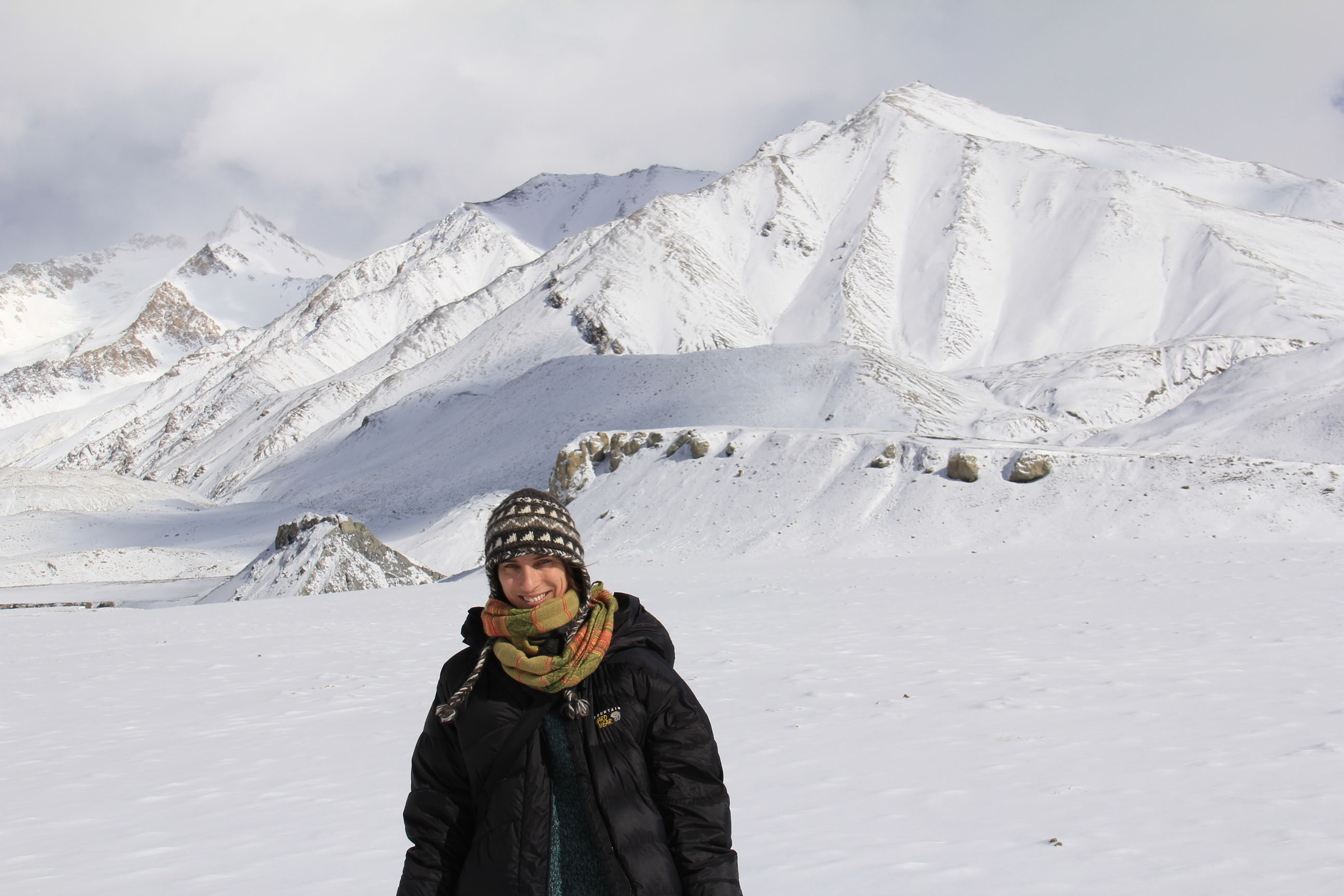
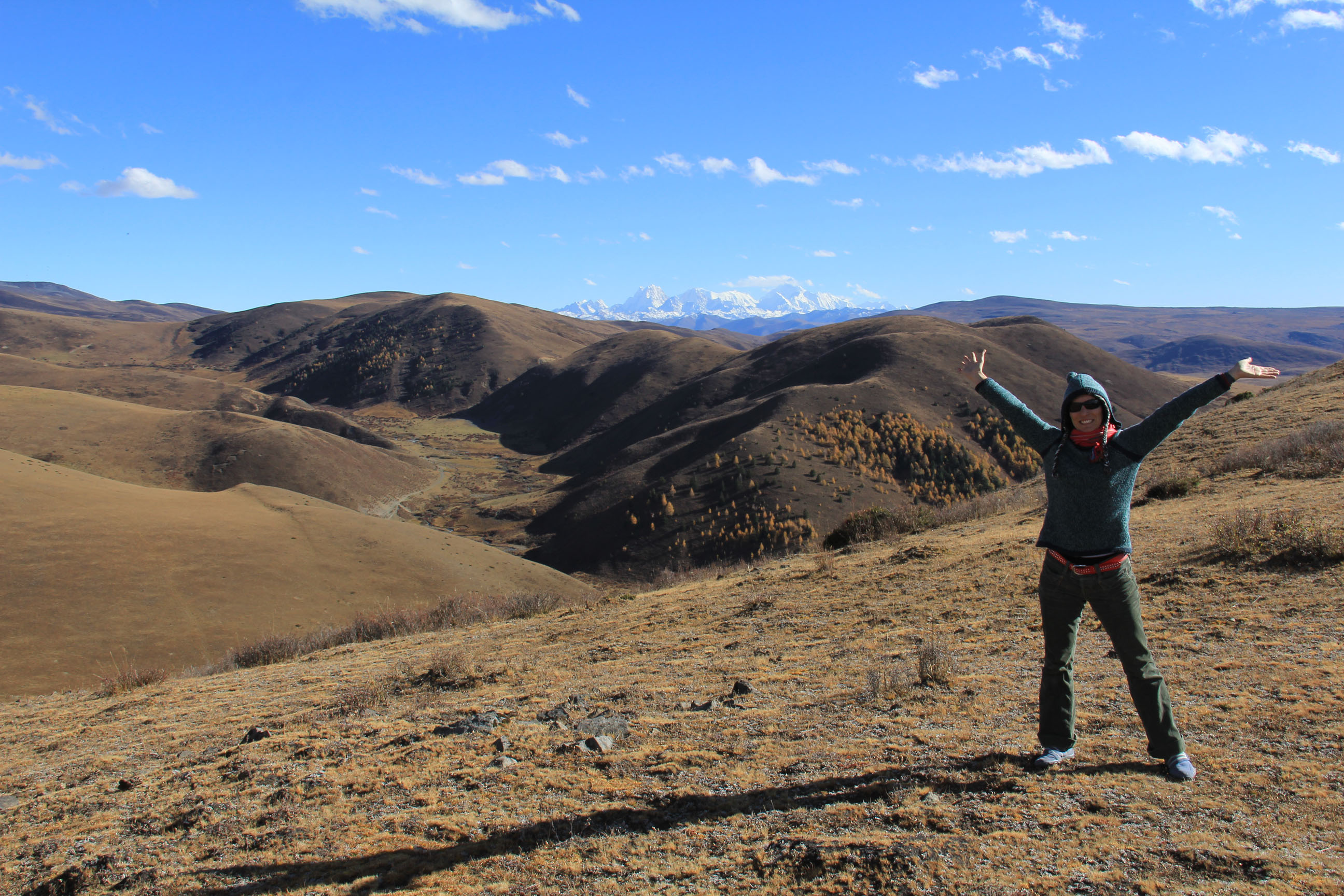
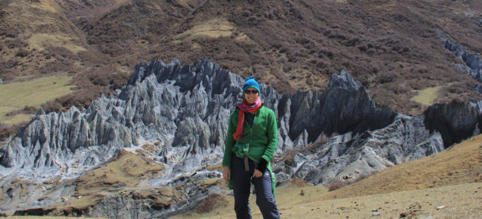
Fieldwork is always an adventure! Because we work in very remote places on the Tibetan Plateau (especially in western Tibet), there are almost no roads (it can be very bumpy for days) and no villages or people (even though it gets better and better). This means we have to sleep in tents under freezing temperatures, with no running water (no shower), cook ourselves, carry our own gas for cars, among other things. The weather is also harsh. In one day, it can snow, rain, get hot, or be very windy. I have been stuck in snowstorms, sandstorms, hail storms; these give amazing photo opportunities as well! Also, being at high elevation is quite hard. At the beginning, you don’t sleep well, have headaches and nausea, and difficulties breathing. But eventually your body adapts, even if each step requires a tremendous effort when you are at 5,000m above sea level! By then, you’re rewarded with stunning nature and landscape, amazing wildlife (Tibetan horses called kiangs, wild yaks, blue sheep, even bears and wolves occasionally!), astonishing temples or local architecture, as well as by very welcoming local people with their own culture. You get to go to these beautiful places where most people will never go!
What are some of the interesting places you have been to?
My research is mostly focused on mountains of the Tibetan Plateau: Tibet (Everest, Kailas, Gongga Shan, Kongur Shan, etc), Xinjiang (Pamir, Tian Shan, Karakorum highway to Pakistan), Western Sichuan (Litang and Ganzi areas), Western Yunnan (Nujiang, Lijiang areas), Gansu etc. Once in a while, we drive past a tourist place or a temple or hot spring and relax and enjoy for a bit. So even though it’s work, it feels like a vacation sometimes!
Also, the international conferences are held in different places around the world. One is always in San Francisco, California, but the other main conference changes countries every year (France, Germany, Hong Kong, Italy).
How has geology changed your perspective on life?
As I’m an outdoor person who loves hiking, exercising, taking photos, and traveling, I have this immense chance to do all that in my job. While in the field, you meet these amazing local people from different cultures (mostly minority people) and ways of living. You can learn a lot. It makes you humble to see what conditions other human beings live sometimes, and how happy and open to others they are despite their very basic living conditions. Also, working with people from all around the world is very interesting, you need to adapt to other cultures’ way of working. Also, seeing the damages that even a small magnitude earthquake can produce makes you realize how little power you have compared to Mother Nature. That makes you want to enjoy life and live it as fully as you can!
How did you come to the point that you wanted to pursue geology? What knowledge, skills, or experiences would be necessary?
I first wanted to become an astronaut or a volcanologist (I’ve always been fascinated by volcanoes), so I did my bachelor in physics (in Belgium), then a master in geophysics in Paris, France. I then pursued with a Ph.D. in the Tectonics of Tibet (still in Paris), and finally a postdoctorate in paleoclimate of Tibet (in California). You need to like studying and researching on a particular subject, you need to be ready to move abroad (not always necessary, but highly recommended for your career). You also need to be able to organize your own time since you are kind of your own boss in your job. Only you know your subject better than anyone. Research can be so specific that only a few people in the world may work on a similar topic. In addition, good computer skills are necessary nowadays since most of our job is on the computer: reading and writing papers (your first paper may not be your best writing but you will learn to write better and better with experience), making nice figures or graphs that will be published, and reviewing other scientific publications from your peers before their work can be published. Also, good communication is a plus since part of your job is to present your work to others (scientists, but also a broader audience) in conferences, or when you are invited to give a talk to another department in another university.
What’s your family/friends’ reaction when you first decided to become a geologist? And now?
My job fascinates a lot of people and they envy me because I’m free to organize my time as I want and I travel to beautiful places, where not many people have been. But even though I love it, when doing fieldwork, it’s not easy to be outdoors all the time with very little comfort in terms of sleeping, food, and others. It’s physically very demanding to be at such high elevation as 4,000-5,000 m, hike for hours, with harsh weather conditions, carrying heavy rocks etc. It’s not for everybody but it works for me! My family and friends are very supportive and have always encouraged me in my studies and hobbies. As a kid, I was always running around, picking up flowers and rocks, hiking, doing sports, traveling, and camping since I was 3 months old. I was not a kid that was reading books or watching TV all day!
What do you think to be the essence of geology and why should people study or work on it?
Studying earthquakes and active faults is very important to understand how the landscapes we know today evolved through geologic times, and what by mechanisms they were created. Possibly one day, one may be able to “predict” earthquakes, or at least, as it is the case for very well studied active faults such as the San Andreas fault in California, know at what frequency large earthquakes happen (every 150 years or so) and where the seismic gaps (place where there hasn’t been a large earthquake in a long time) are located. What people can do now is be prepared, build safer structures, and know how to respond.

Photos: Courtesy of Marie-Luce Chevalier
